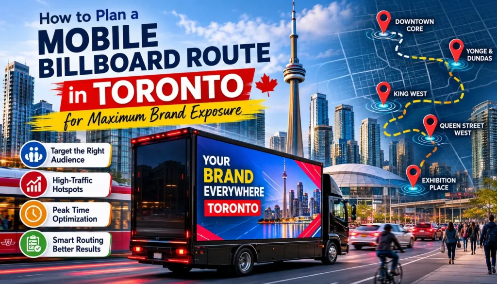
Traditional out-of-home media treats human attention as a constant, expecting audiences to reliably pass by a fixed point on a highway. True market visibility, however, requires understanding that urban crowds are hyper-fluid. In a sprawling metropolitan ecosystem like the Greater Toronto Area, maximum exposure is achieved when your asset adapts to the rhythm of the city’s population shifts.
Successful mobile billboard route planning in Toronto relies on an operational framework that treats traffic patterns, neighbourhood demographics, and city events as variables in a real-time pathing strategy.
1. Demographic Micro-Zoning Across the GTA
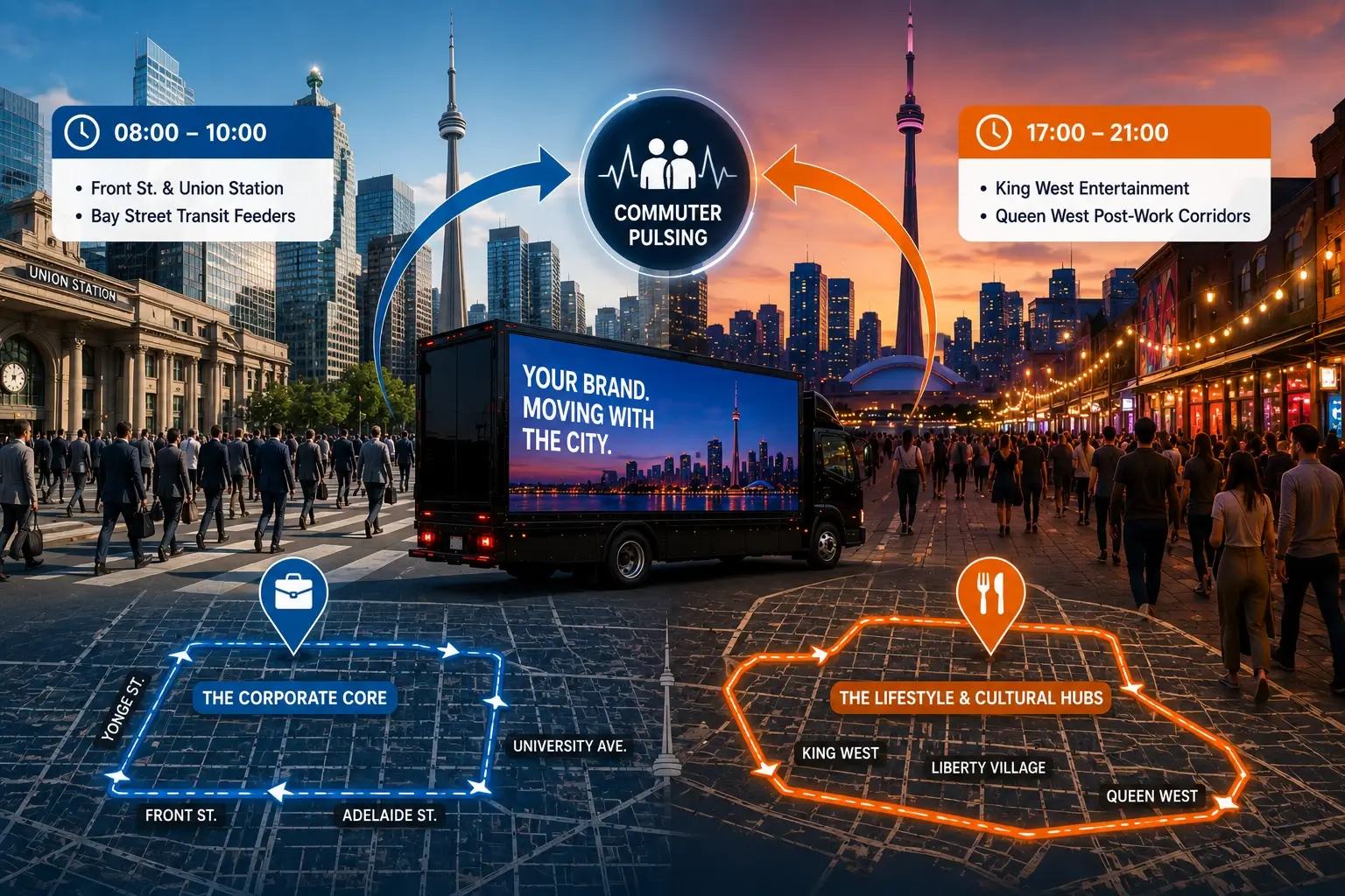
Treating Toronto as a single market is the fastest way to dilute an advertising budget. A vehicle’s physical location must change relative to the changing profile of the sidewalk population throughout the day.
[08:00 - 10:00 ]
- The Corporate Core:
- Front St. & Union Station
- Bay Street Transit Feeders
[17:00 - 21:00 ]
- The Lifestyle and Cultural Hubs:
- King West Entertainment
- Queen West Post-Work Corridors
- The Corporate Core: Between 8:00 AM and 10:00 AM, high-net-worth decision-makers are concentrated within the financial core – the concentrated footprint bounded by Front, Yonge, University, and Adelaide. Circulating this grid captures attention during the critical morning transition.
- The Lifestyle and Cultural Hubs: By mid-afternoon, consumer attention shifts west. The modern professional workforce moves toward the commercial and culinary corridors of King West, Liberty Village, and Queen Street West.
Aligning your route with this daily movement guarantees your messaging remains highly relevant to the surrounding crowd. For a strategic breakdown of how this fluid positioning compares to rigid, long-term outdoor lease structures, review our deep dive into Mobile Billboard vs Static GTA.
2. Dwell-Time Optimization: Turning Friction Into Reach
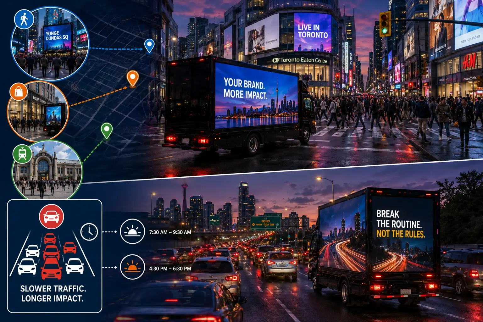
Many traditional media campaigns view traffic congestion as a logistical hurdle. An effective outdoor advertising route strategy flips this friction into a distinct advantage, identifying points where slow-moving vehicle and pedestrian traffic increase ad viewing times.
Transit Funnels and Core Intersections
- The Yonge & Dundas Corridor: Acting as Toronto’s central civic hub, this zone provides high pedestrian numbers where street infrastructure naturally slows foot traffic, maximizing your screen time.
- The Bloor-Yorkville Retail Grid: This sector offers access to high-earning consumers navigating a tight, slow-speed grid of luxury retail streets, providing excellent viewability for premium brands.
- The Union Station Funnel: The morning and evening rush hours convert Front Street into an exceptionally dense pedestrian walkway, giving brands a high-impact window to capture commuters.
The Commuter Crawl
Running digital assets along the Don Valley Parkway (DVP) or the Gardiner Expressway during the peak gridlock windows (7:30 AM – 9:30 AM and 4:30 PM – 6:30 PM) places your creativity directly in front of stationary, captive drivers. At a crawl, a shifting digital screen breaks up commuting monotony far more effectively than an over-saturated roadside sign.
3. Dynamic Temporal Routing around Major Event Hubs
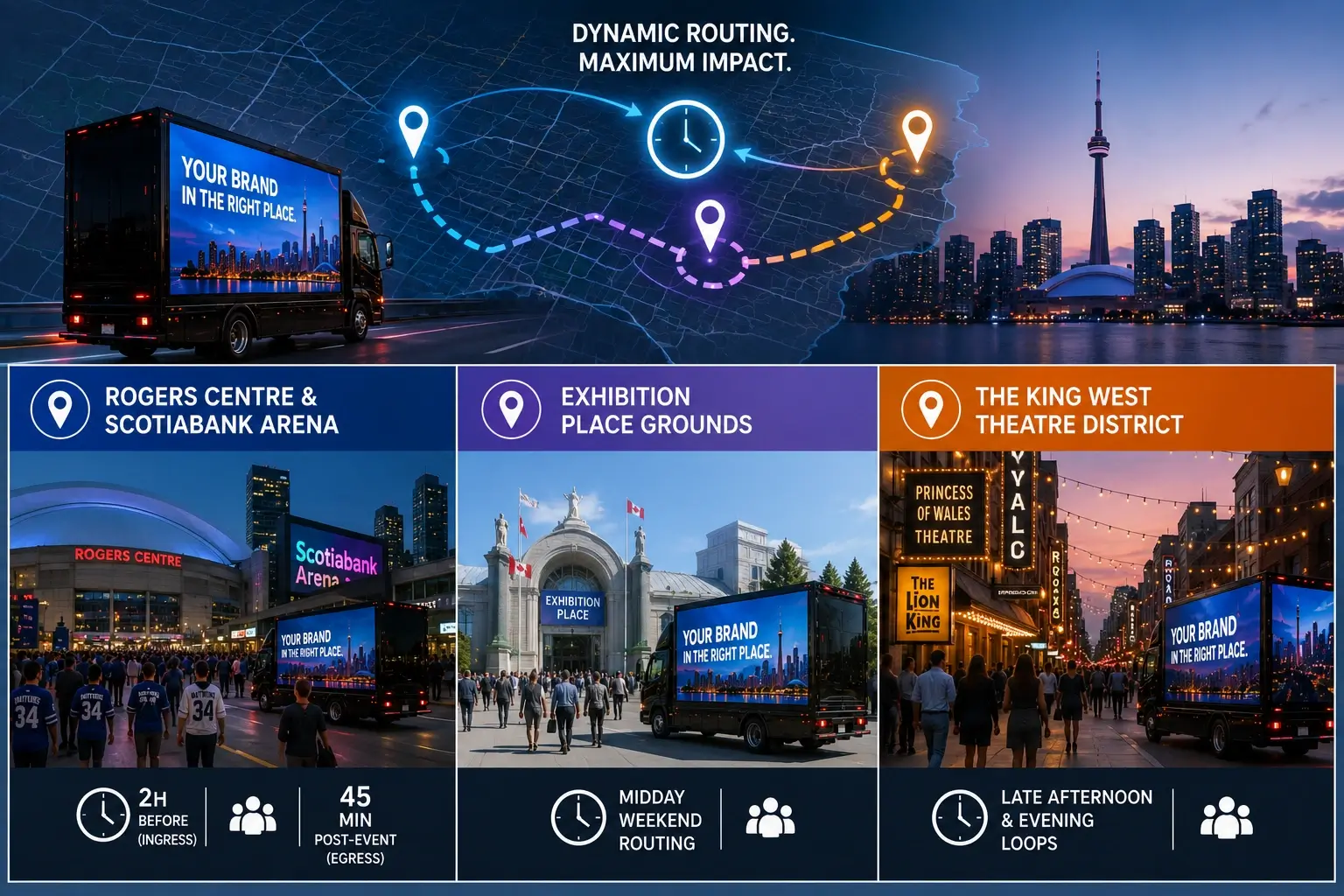
One of the unique advantages of an LED truck advertising Toronto GTA deployment is the ability to adjust your location based on major entertainment schedules, bypassing the long-term ad contracts that dominate stadium perimeters.
| High-Density Event Zones | Target Audience Profile | Optimal Route Timing |
|---|---|---|
| Rogers Centre & Scotiabank Arena | Sports fans, concert-goers, mass consumer markets. | 2 hours before the event starts (ingress); 45 minutes post-event (egress). |
| Exhibition Place Grounds | Trade show attendees, convention delegates, seasonal consumers. | Midday weekend routing during active programming. |
| The King West Theatre District | Cultural tastemakers, entertainment professionals, media buyers. | Late afternoon and evening operational loops. |
4. Operational Compliance and Street-Level Reality
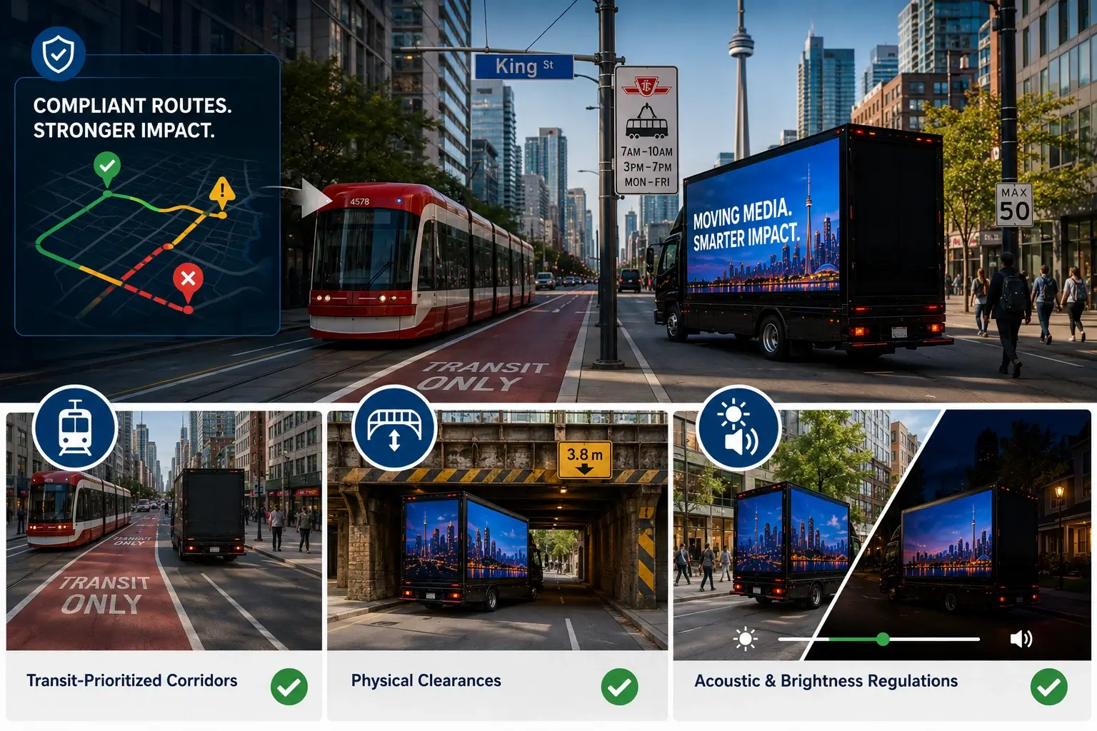
The most creative route design will fail if it runs into city enforcement issues or physical road barriers. Designing an effective route in the downtown core requires a solid understanding of Toronto’s unique street layout and local bylaws.
Key Mapping Considerations:
- Transit-Prioritized Corridors: Routes must account for streetcar-only transit priority zones, such as sections of King Street, where slow commercial cruising or frequent stopping is restricted.
- Physical Clearances: The West End and lower industrial corridors feature low-clearance rail bridges. Vehicles must be carefully mapped onto routes that protect high-clearance digital frames from structural hazards.
- Acoustic and Brightness Regulations: To keep operations running smoothly, screen brightness (measured in nits) and audio support must be adjusted dynamically as the vehicle moves between commercial zones and mixed residential neighborhoods.
Failing to account for these specific municipal rules can quickly disrupt a campaign’s momentum. To avoid these common pitfalls, check out our guide on the 9 Common Mistakes in Mobile Billboard Placement.
Also Read: How to Advertise During FIFA World Cup 2026 Without a Huge Budget
Deploying Your Toronto Route Mapping
An effective route transforms a mobile digital display from a simple moving advertisement into a precision-targeted media campaign. By syncing your vehicle’s path with real-time transit data, local crowd behavior, and municipal regulations, you ensure every kilometer driven delivers maximum consumer impact.
Want to explore how moving digital canvases are shifting the outdoor media landscape? Read our industry perspective on the Power of Mobile Billboard Advertising, and connect with our team to build a high-visibility route tailored specifically to your campaign goals.
FAQs
No, commercial vehicles cannot slow-cruise or stop along the restricted transit zones of King Street (between Jarvis and Bathurst). Our mobile billboard route planning Toronto experts bypass this restriction by designing heavy perimeter loops around Wellington, Adelaide, and intersecting north-south avenues. This keeps your ad highly visible to the King West crowds without violating municipal transit laws.
Toronto’s roadwork shifts constantly, which can completely block planned lanes or alter pedestrian walkways. We actively monitor daily city construction closures and TTC route diversions to adjust your vehicle’s GPS paths in real time. If a key core intersection gets bottlenecked by a sudden lane reduction, our drivers shift immediately to adjacent alternative secondary corridors to maintain your impression counts.
Yes. Certain historic underpasses – particularly in older sections of the West End (like the rail bridges near Liberty Village or Davenport) – have strict maximum height clearances that standard large-scale LED trucks cannot clear safely. Additionally, specific residential and parkside roads carry commercial vehicle weight bans. We screen every custom outdoor advertising route strategy to ensure full compliance with Toronto’s infrastructure specifications.
During heavy rainstorms or typical winter delays, highway speeds drop drastically. Instead of pulling trucks off the road, we optimize for the slower pace. A slow-moving or gridlocked highway creates a massive spike in ad dwell time from captive, stationary commuters, making weather slowdowns some of the most high-impact windows for campaign visibility.